Fighting Crime with Space Technologies
Organized crime remains a profound challenge all over the world, posing a threat to both developed and developing countries.
Colony 87. Astronauts 11 414.
We invite you to join the first professional investment community on AngelList focused exclusively on space tech investments: Beyond Earth Technologies
The use of space and space-enabled technologies by law enforcement has been increasing over the last decade. This week, we highlight some of the most common use cases of how spacetech innovations can help curtail crime. Organized crime remains a profound challenge all over the world, posing a threat to both developed and developing countries. More commitment and investments might ensure law enforcement has a much-needed edge in the crime race.
Satellite Surveillance and Monitoring
High-resolution satellite imagery has become increasingly affordable and accessible to law enforcement agencies, enabling the surveillance of extensive areas, including those that are challenging to reach using traditional methods.
In 2014, British police used satellite imagery to locate a murder victim’s body in a remote location near Manchester. The satellite detected subtle ground disturbances that were difficult to notice from the ground or even with aerial photography. In addition, VISAR technology, initially developed to track weather phenomena and analyze satellite video, has been adopted by law enforcement agencies like the FBI. For instance, the technology assisted with crimes like the 1996 Olympic bombing.
Brazil’s police use satellite images to investigate illegal deforestation. Using monitoring platforms like Forest Watch, the police officers identified 5,000 areas of deforestation in Amapá and conducted more than 50 operations combating illegal deforestation over just 8 months in 2018-2019. The government of Brazil subsequently partnered with Planet Labs to ensure increased resolution and more frequent satellite updates.
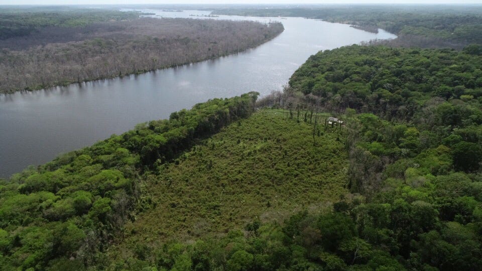
Forest crime is a growing problem with links to organized crime and corruption with low legal and financial penalties making it more appealing compared to human or drug trafficking. Moreover, inefficiencies in judicial systems in developing countries often delay punishment for these crimes.
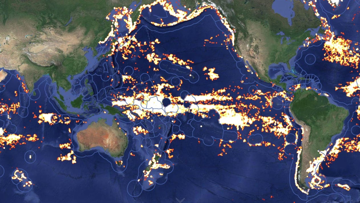
Governments also cooperate with satellite imagery companies to combat illegal fishing. Global Fishing Watch (GFW) reports that illegal or unregulated fishing accounts for up to 20% of the annual catch, representing a black market worth up to $23B. To address the problem, GFW uses AI and satellite imagery to map the movements of more than 65,000 vessels, both with and without the GPS-based automatic identification system (AIS) that transmits the vessel’s position. If a vessel’s AIS is turned off, it may indicate that the vessel is engaged in illegal fishing.
A project from the University of Southampton and RS Aqua aims to aid the authorities by developing a submarine robot equipped with underwater sensors and AI. The robot can detect the sound of fishing, and transmit the information real-time. The AI can already distinguish between the natural sounds of the ocean, and is now being trained to identify the noise of boats illegally operating in protected waters with their AIS turned off.
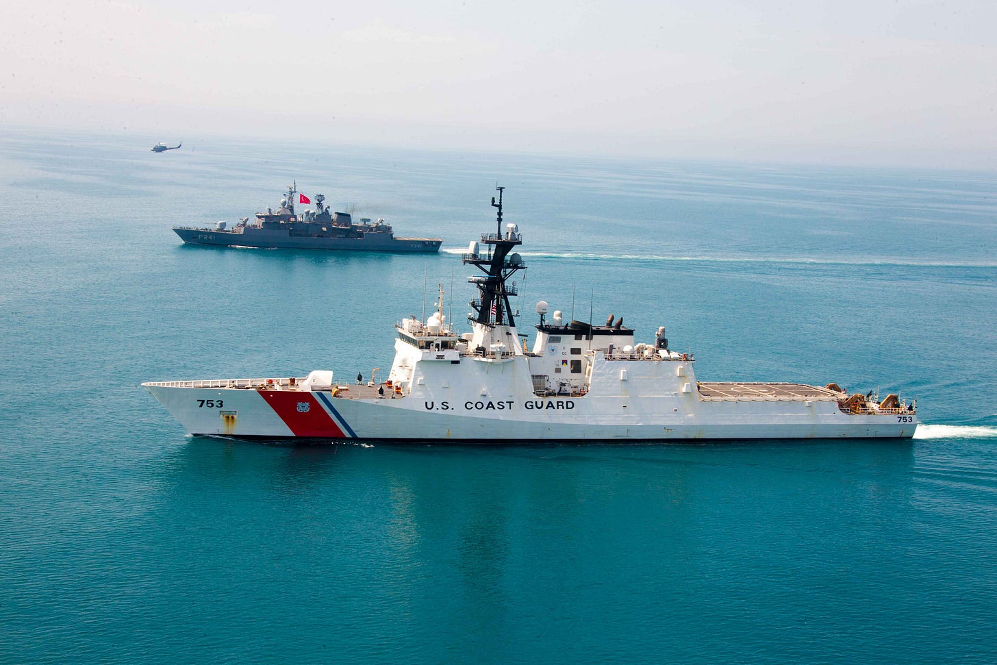
The use of satellite imaging has become a top priority in the fight against drug trafficking. In a recent Navy experiment, commercial satellites were used to show how space technologies can quickly feed actionable intelligence to law enforcement about illegal drug-trafficking boats that turn off their lights at night and do not emit radio signals.
The military deployed a network of acoustic sensors on small buoys that detected noise signatures off drug running vessels. Planet Lab’s electro-optical and ICEYE synthetic aperture radar (SAR) satellites were used to capture images of the moving vessels. The intelligence was then shared with an AI platform which identified the vessels and dispatched maritime patrol aircrafts when necessary. Using imagery analytics software, the total time from acoustic detection to vessel report was about 30 minutes. Given that most drugs enter the US and Europe by sea, such initiatives can significantly strengthen law enforcement capabilities.
Drones and UAVs
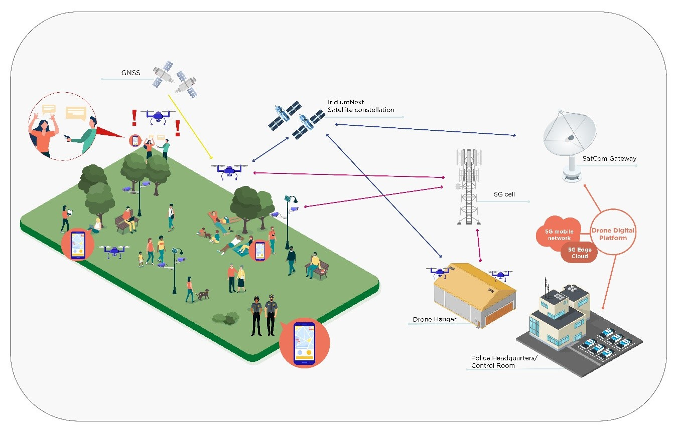
In a pilot demonstration in 2022, the S-EDGE (Satellite and 5G for Law Enforcement application) system showed how it could assist police forces in locating missing persons, safeguarding police officers during armed suspect searches, aiding disaster relief and recovery, and even supporting crowd management.
The S-EDGE system’s drones are designed to survey and patrol designated areas while continuously transmitting data to a central platform. Each drone is equipped with optical and thermal imaging cameras. Because of the 5G network infrastructure and satellite connectivity, they can provide real-time data to users, including video streaming.
While S-EDGE is a concept program that is yet to be implemented in Europe or anywhere else, drones are already being used by a few police departments. The Denver PD has launched the “Drone as First Responder” program, which helps officers responding to 911 calls. In some instances, a drone may be deployed to verify reports made to 911 or assess their severity. Given that the city recently cut the department’s budget, the initiative will help optimize the PD’s resource allocation.
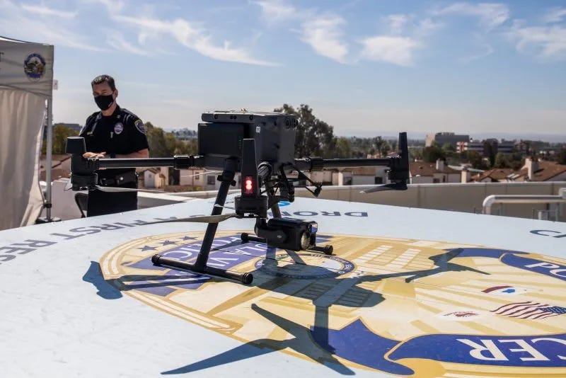
In 2018, Chula Vista, a border city in California gained national attention by becoming the first in the US to launch the “Drone as First Responder” program. By using drones and satellite technology to investigate thousands of 911 calls, the city has reduced unnecessary police work and decreased response time. Despite concerns about privacy and excessive surveillance, most residents support the program.
Policing in Space
How would law enforcement go about investigating crimes in space?
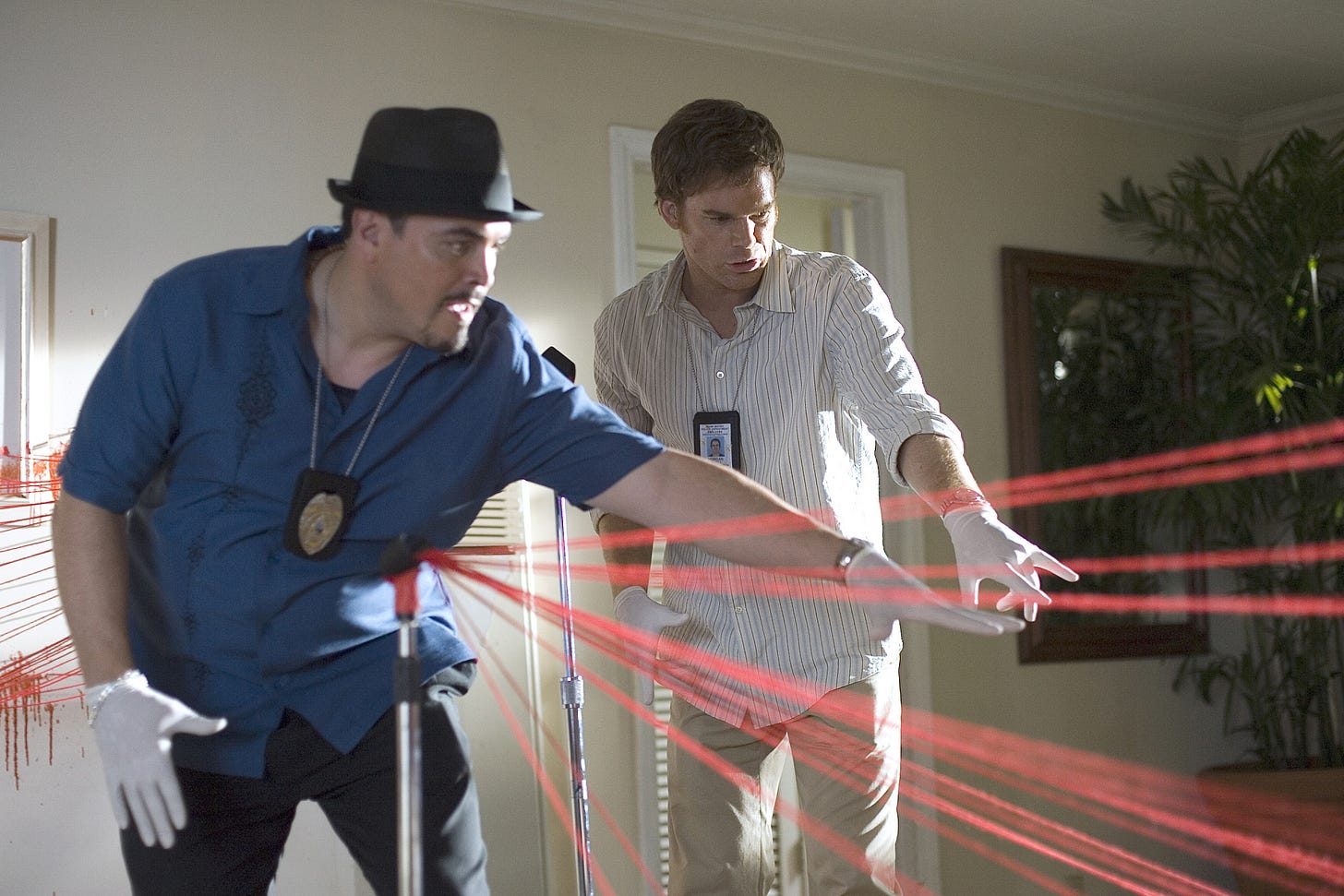
Investigating crimes in space presents unique challenges due to the harsh environment. The significant reduction in gravity in space affects evidence behavior, such as bloodstain pattern analysis, which relies on gravitational effects to determine how blood stains form. Considering that most environments in space have low or microgravity, more research is needed to better understand how altered gravity can influence forensic analysis.
Kowalske, a PhD researcher at Staffordshire University, and Pantalos, a cardiovascular psychologist at the University of Louisville, are among the few who are exploring astroforensics. Their recent study documents a microgravity experiment they conducted to observe how liquids with the viscosity of blood would behave in space conditions.
In the typical gravity environment, liquid blood drops will undergo a series of stages in the stain creation process. This entails the droplet’s collapse, the formation of a small wave, and the spread into a final stain shape. However, when gravity is eliminated, the spreading action is inhibited by the dominating force of surface tension and cohesion, resulting in a stain shape and size that is smaller than its terrestrial twin.
Future research can assist astronauts, colonists, and space detectives with the analysis of accidents or catastrophic events in space.
If you know of any other use cases or initiatives, we’d love to learn more! Contact us at hello@spaceambition.org


