Earth Observation Use Cases
The most painless way to start investing in space for many non-space companies is to start using the Earth observation data. We tried to focus on 6, that we found mostly interesting.
Issue 83. Subscribers 11 230.
Unlock exclusive access to our handpicked selection of top deep tech investment syndicates, premier space conferences, and a comprehensive list of space investors and accelerators. More information here.
Earth observation, or remote sensing, has been one of the first and key applications of satellite technologies since the Soviet Union launched the first satellite back in 1957. Although in essence Sputnik-1’s main purpose wasn’t to study earth, the signals it sent back helped scientists understand the ionosphere.
Today, remote sensing has become an invaluable part of research, science and technological development. Many countries are now considering launching their own EO-satellites . As of May 2024, there were nearly 1,355 Earth observation satellites in orbit. This number grew dramatically with 123 satellites launched in 2023 alone and 57 more in the past months of 2024 (according to the UCS database and other open sources).
The variety of instruments used for Earth observation is huge and includes radars, lidars, ultraviolet, infrared, optical, hyperspectral, and other exotic sensors. At the same time, Earth observation solutions represent a significant portion of all satellites.
Meteorology
One of the primary applications of the Earth observation is meteorological research and monitoring, covering the whole spectrum of topics: from macro analysis to local weather forecasts. But even a simple weather forecast relies on extensive data from both ground-based and in-space sensors, including ultraviolet measurements, cloud monitoring, temperature readings, provided by optical, ultraviolet, infrared, multispectral, and radar payloads.
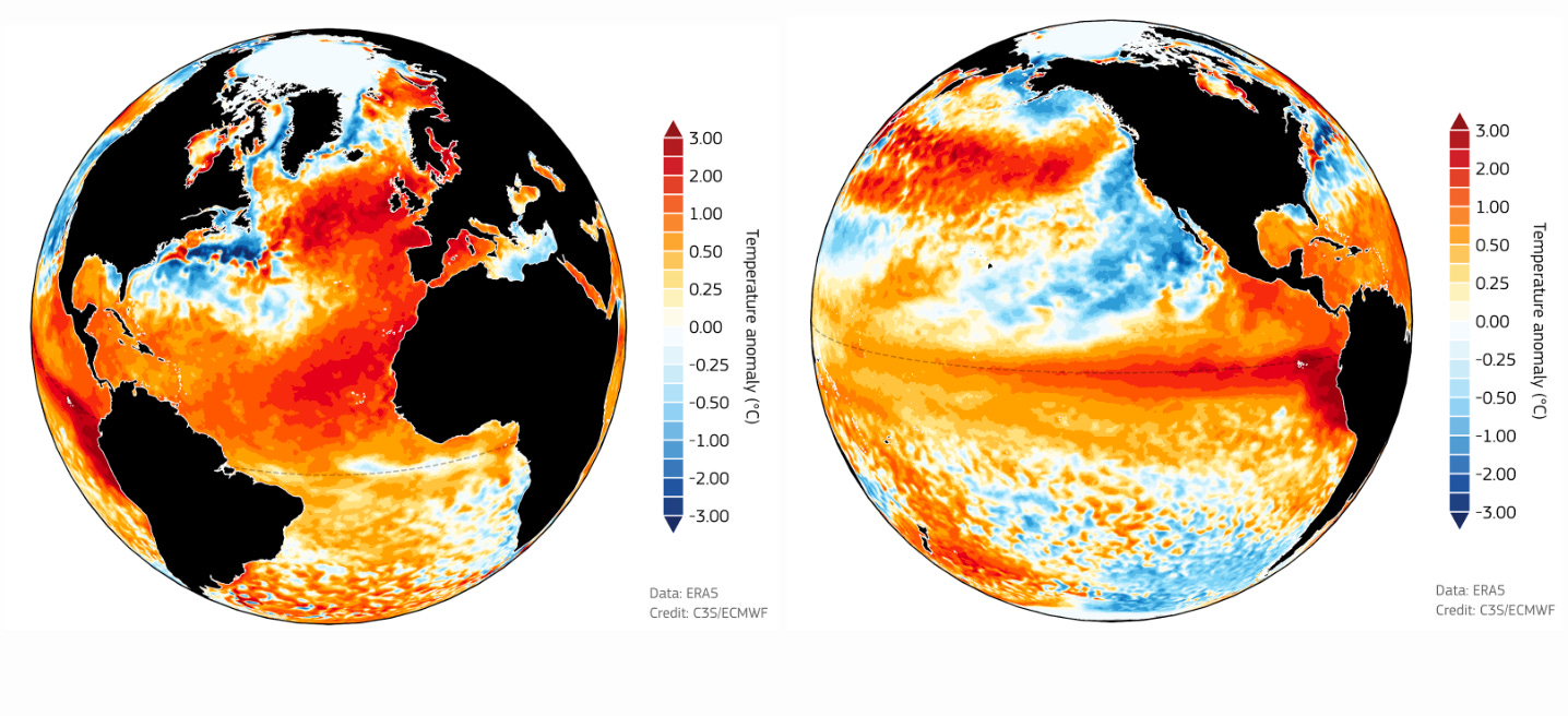
With a growing number of observations, and thus a volume of historical data, we can now identify weather global trends and monitor climate change. In November 2023, the World Meteorological Organisation declared 2023 the hottest year on record, based on data from various satellites and instruments, including, for example, ERA5 radiometer on the Sentinel-3 mission.
Natural Disaster Monitoring
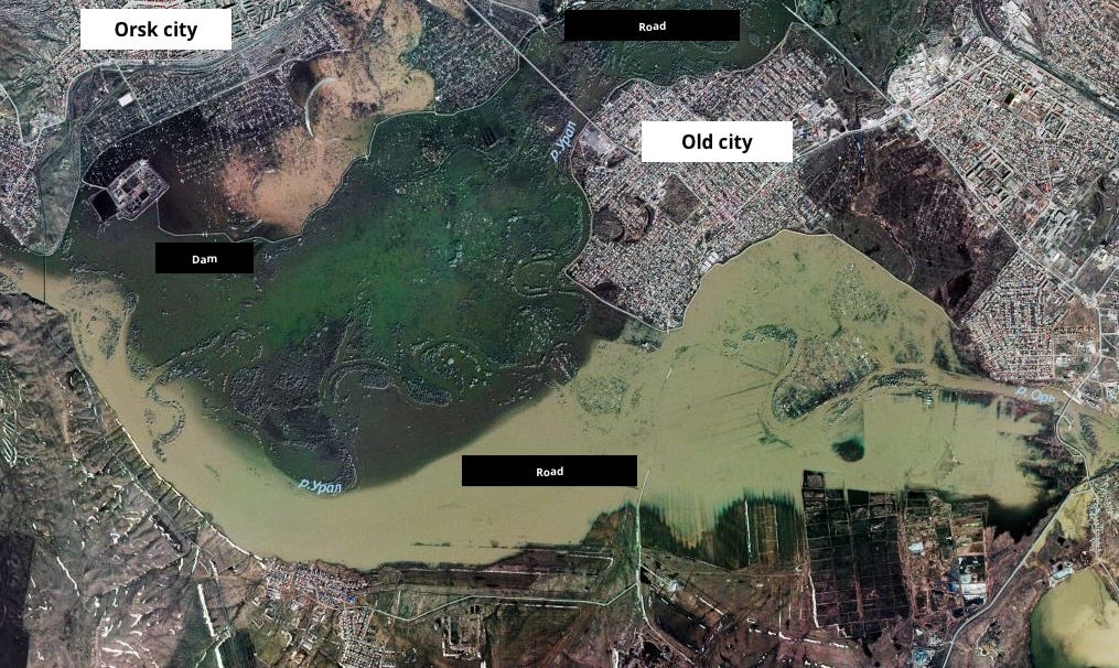
Monitoring and predicting the weather is as important as tracking natural disasters. Actually it’s not only meteorologists who care, governments, finance and insurance sectors are also keen on accurate and timely data about tornados, wildfires, floods and other disasters. For instance, a massive flood in Russia and Kazakhstan in April 2024 (the most significant in the last 80 years) led to the evacuation of over 100,000 people and damaged nearly 20,000 houses. Satellite imagery helped government services in orchestrating rescue missions as well as tracking the dynamics of the catastrophe.
Human-made Disasters and Infrastructure Monitoring
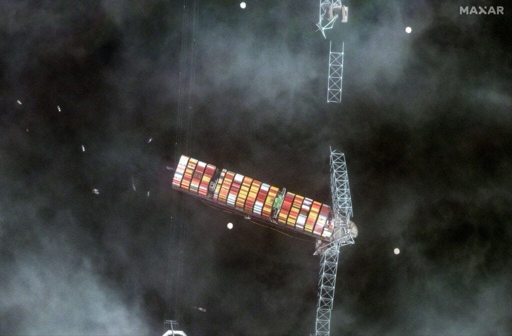
Along with natural disasters, human-made disasters also require monitoring. Late night March 26th the cargo ship “Dali” crashed into the Francis Scott Key Bridge in Maryland, causing fatalities and disrupting transportation. In this case, as well as many others, space images are invaluable data for the ongoing investigations.
Not only that, but satellite imagery also helps monitor critical infrastructure like transportation, energy, manufacturing objects.
Ecological Sustainability
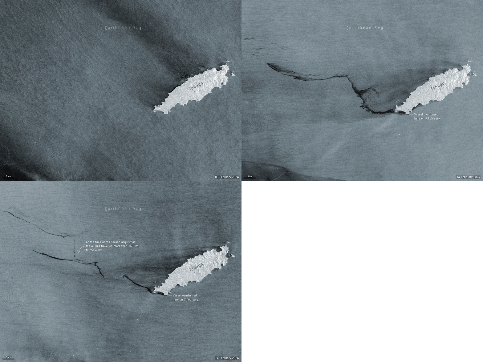
With growing environmental concerns, monitoring ecological impacts is essential. This includes tracking changes in the environment, forestry, emissions control, and more. For example, a significant oil spill in Tobago in February 2024 was tracked using Sentinel-1’s C-band radar instrument.
With growing environmental concerns, it becomes absolutely essential to monitor ecological impact. This includes tracking changes in the environment (remember this iceberg nearly as big as the whole Bay Area broke away from Antarctica in January last year?), forestry watching, emissions control, and many other activities.
In February 2024 an enormously big oil spill hit The Island of Tobago, leading to the government almost declaring a national-wide emergency. Using the data from Sentinel-1's radar, the spill movements were tracked.
Science
Another important case for remote sensing data is scientific research across various fields, from assessing biodiversity to understanding the nature of Earth's magnetic field. Researchers bring out the most exotic instruments, so the widest range of payloads is being used for scientific purposes.
In May 2023 Nature published a review article by Christopher C. Finley et. al on research of the inner processes in the Earth core and fluctuations of the magnetic field. The publication celebrated the 10th anniversary of the ESA SWARM+ 4D project.
Natural Resources Management
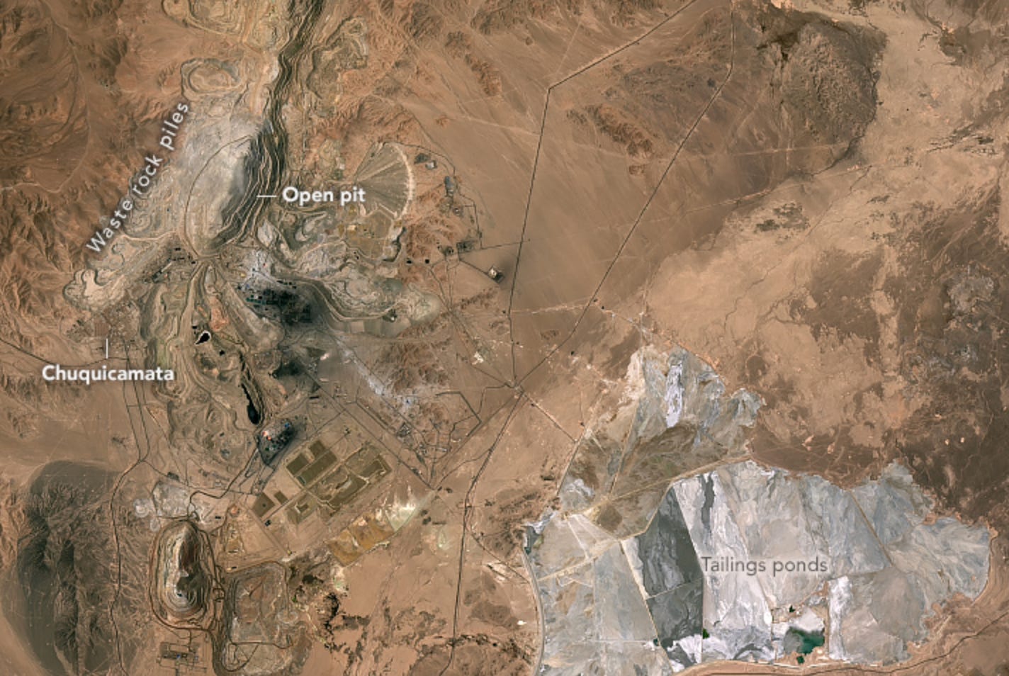
Remote sensing data is crucial for managing natural resources. This data is widely applied to different cases, including discovering new mines, monitoring the extraction process, and managing the natural resources from the government perspective. Analysis usually includes many data sources, such as multispectral and optical sensors, radars and lidars.
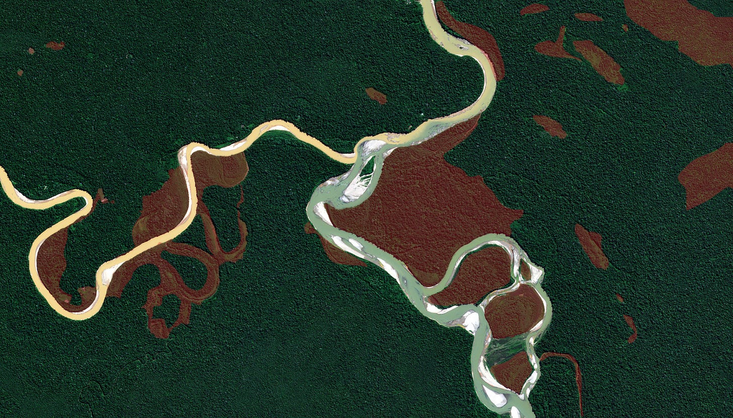
The deforestation issue of Amazonia, especially in Brazil, has been known for a long time. In 2023 Planet published additional data related to the same issue in Peru.
Additionally, there are applications of using Earth observation data for geological explorations.
Economy and Finance
Satellite data can help predict economic trends. Early signs of an upcoming inflection point in economic growth may include satellite images of logistic hubs, ports, and construction sites. One of many examples is the forecasts regarding the recovery of the Chinese economy in September 2023 proved by the actual statistics later. Furthermore, macro analysis is not the limit of this approach. Space imagery can be used to predict the financial performance of public companies, such as huge retailers or developers.
Of course, this is not an exhaustive list, as we tried to highlight only a few of the most interesting use cases. Besides those mentioned in the article, there are other applications including national security, risk management, urban planning, agriculture, and many others. We’ve already covered some of these topics, so check out our articles related to the Earth observation: greenhouse gases emission monitoring – part 1 and part 2, agriculture.
Also, during the Space Ambition pitch session in May 2024, we were happy to have three Earth observation companies pitching. Airmo is planning to track GHG emissions with the constellation, equipped with lidars; SkyFi is making EO data more accessible though its platform; and Esper is building hyperspectral instruments to provide data for resource-based industries.
At Space Ambition we believe that remote sensing might be a very promising field. If you have any ideas to discuss, want to brainstorm or looking for support, feel free to reach us out at hello@spaceambition.org. We’re happy to give you a hand.


I wonder, what were the criteria of selection of these use-cases. Do you find them the most promising for the commercial companies to engage?